






Guide to Maps
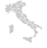
Enologik maps are tools designed to discover and appreciate wine diversity starting from the territory. Each wine map shows at a glance our selection of wines for each region, from wine areas to individual vineyards. These are topographic maps that show the most relevant information for wine production, such as vineyard exposure, altitude and latitude, soil composition, proximity to water bodies and climate indices.

Wine Macroregion
Macroregions are extensive territories, defined based on historical, cultural, topographic and oenological characteristics.


Distribution of wine areas
The colored portions on the map correspond to the individual wine areas belonging to the macroregion.

Metric scale
Allows better understanding of the extension of wine areas and the macroregion as a whole.
Latitude
Latitude is essential data, as it determines the main climatic characteristics of the macroregion.
Wine Area
Wine areas are territories ranging between 1000 and 1400 km² approximately, with more homogeneous characteristics compared to those of the macroregion.


Microareas
The colored portions on the map correspond to the individual wine microareas belonging to the wine area.

Elevation scale
Through the use of colors, the map highlights the altitude, which affects the characteristics of the grape and therefore the wine.
Climate indices
The climate indices show for each area the number of rainy days, the average daily rainfall and temperatures according to the Huglin index.
Wine Microarea
Microareas are portions of territory of 57 km². They show contour lines, soil composition, and the arrangement of individual vineyards for a specific portion of a wine area.


Vineyard distribution
The shapes solid and dashed indicate the exact or approximate position of individual vineyards or wineries.

Soil composition
The detail level of the microarea allows to appreciate the soil composition, which contributes to determining the grape characteristics.

Contour lines
Contour lines allow to appreciate the elevation position of vineyards shown on the map, with greater precision compared to elevation scales.
Subscribe to the newsletter!
Subscribe to the newsletter for news about wines, areas and producers.
Wine Diversity
The variability of wines produced within a specific wine area.
Proximity to Water Bodies
The presence of water bodies (rivers, seas, lakes, etc.) influences the microclimate, causing variations in grape production even between vineyards belonging to the same microarea.
Rainy Days
The number of rainy days is the number of days, between April 1 and November 30, in which the total amount of rainfall exceeded 1mm. The value reported in the table is the average for the period 2000 - 2019
Daily Rainfall
The number of mm/day indicates the average daily rainfall, for each day between April 1 and November 30, where the total amount of rainfall exceeded 1mm. The value reported in the table is the average for the period 2000 - 2019.
Huglin Index
The Huglin index is an annual climate index commonly used in viticulture, calculated based on latitude and the average and maximum daily temperatures between April 1 and September 30. Optimal values for viticulture range between 1500 and 2400. Values close to or below 1500 indicate particularly harsh climates, while values close to or above 2400 indicate particularly warm climates. The value reported in the table has been specifically calculated for the area represented by the map, and is the average for the period 2000 - 2019.
Vineyard Shapes
The solid outline ellipse indicates the exact position and extent of a single vineyard, or a group of vineyards.
The dashed outline ellipse (long dashes) indicates the approximate position of a vineyard, or an approximate area within which multiple vineyards are located.
The dashed outline square (short dashes) indicates the position of a winery. In this case, it was not possible to indicate the position of the vineyards because the producer does not provide information about them, or the vineyards are distributed within a larger area than shown on the map.


explore
- All wines
- Territories
- Grapes
- Denominations
- Producers
about us
- About
- Wine diversity
- Map guide
- Search guide
- Work with us
- Sustainability
support
- Help
- Shipping
- Payments
legal
- Privacy policy
- Cookie policy
- Terms of use
- Terms of sale
- Legal info
Follow us


You can pay with:


We ship with:


Certified sustainability:

Certified sustainability: